Henderson Park Master Plan
To facilitate the continued growth and needs of the City of Tucker parks system, the City has partnered with Cooper Carry to create a community driven master plan for Henderson Park that preserves the nature features of the site, while identifying potential opportunities to enhance the active and passive amenities.
Project objectives include identifying enhanced aesthetics and functionality of the park; identifying options for underutilized portions of the park; identifying opportunities to expand/improve existing amenities as well as the addition of new amenities; identifying options for additional parking and pedestrian connectivity; and evaluating the potential for additional pickleball courts or a community center to be built within the park. The planning effort will also look at inclusive design elements, public safety improvements, and ways to preserve and promote native plants and wildlife habitats.
The master plan process kicked off in March of 2026 and should be complete by September 2026. There will be lots of exciting public engagement opportunities during this time, which will be posted on this webpage and our social media channels.
Upcoming Public Engagement Opportunity
OPEN HOUSE#2
JUly 16, 6:30 – 8 p.m.
Tucker City Hall, Council Chambers
PRESENTATIONS
Update Presentation to City Council
Monday, June 22
Final Presentation to City Council
Monday, September 14, 7 p.m.(tentative)
Tucker City Hall, Suite 350B
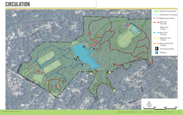
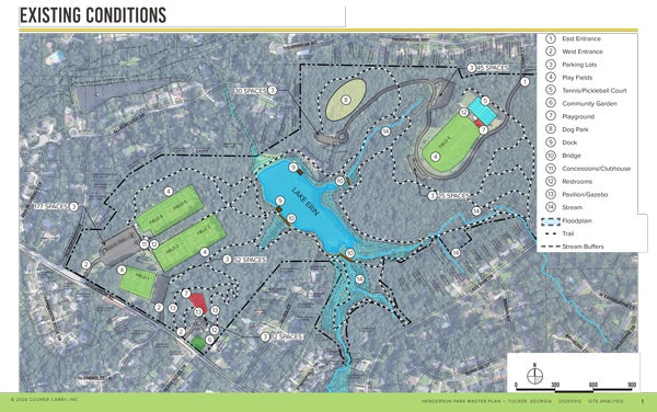
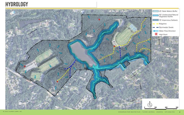
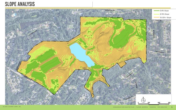
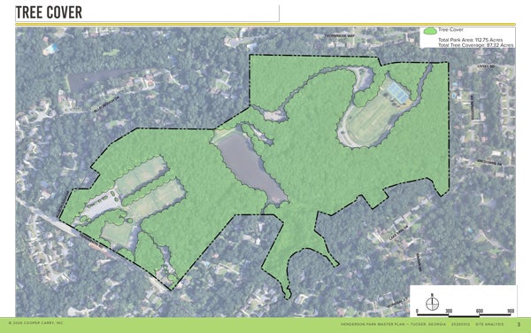
HENDERSON PARK SITE ANALYSIS
Cooper Carry has prepared the following base maps as part of their site analysis work. These maps show the existing as built conditions in the park, including vehicular and pedestrian routes and travel methods, tree canopy, water flow and direction, steep slopes, and environmentally sensitive areas.